


The Trent River is a fresh water river of the coastal plain region of eastern North Carolina. It flows in an easterly direction from its origin approximately 15 miles (24 km) southwest of Kinston, North Carolina and traverses portions of Lenoir County, Jones County and Craven County prior to emptying into the Neuse River at New Bern, North Carolina. Trenton and Pollocksville are small towns that lie along its course. The river measures 720 yards (660 m) at its widest point and is fed by numerous fresh water branches and creeks along its length.
-
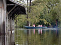 US Geologic Survey team measuring water flow on the Trent River.
 -
 Aerial photograph of the confluence of the Trent and Neuse Rivers. East is up. The city of New Bern is on the left. The unincorporated community of James City is to the lower right. The Trent flows from the bottom center of the picture.


See also
References
- ^ a b "GNIS Detail - Trent River". geonames.usgs.gov. US Geological Survey. Retrieved 4 October 2020.
- ^ a b "Trent River Topo Map in Craven". TopoZone. Locality, LLC. Retrieved 4 October 2020.
- ^ "ArcGIS Web Application". epa.maps.arcgis.com. US EPA. Retrieved 4 October 2020.
- ^ a b "Trent River Watershed Report". US EPA Geoviewer. US EPA. Retrieved 4 October 2020.
You must be logged in to post a comment.