


Săliștea de Sus
Săliștea de Sus | |
|---|---|
 Nistorești wooden church of Saint Nicholas in Săliștea de Sus | |
 Coat of arms | |
 Location in Maramureș County | |
 Săliștea de Sus Location in Romania | |
| Coordinates: 47°39′N 24°21′E / 47.650°N 24.350°E | |
| Country | Romania |
| County | Maramureș |
| Government | |
| • Mayor (2024–2028) | Ștefan Iuga[2] (PSD) |
Area | 64.77 km2 (25.01 sq mi) |
| Elevation | 500 m (1,600 ft) |
| Population (2021-12-01)[1] | 4,856 |
| • Density | 74.97/km2 (194.2/sq mi) |
| Time zone | UTC+02:00 (EET) |
| • Summer (DST) | UTC+03:00 (EEST) |
| Postal code | 437295 |
| Area code | (+40) 02 62 |
| Vehicle reg. | MM |
| Website | salisteadesus |
Săliștea de Sus (Hungarian: Felsőszelistye, Yiddish: סלישט, romanized: Selist) is a town in Maramureș County, Maramureș, Romania. It was declared a town in 2004.
The town is located in the southeastern part of Maramureș County, about 90 km (56 mi) east of the county seat, Baia Mare, on the border with Bistrița-Năsăud County. It lies at an altitude of 500 m (1,600 ft), in a hilly area in the northeastern foothills of the Țibleș Mountains, on the banks of the Iza River.
| Year | Pop. | ±% |
|---|---|---|
| 1880 | 2,166 | — |
| 1900 | 2,793 | +28.9% |
| 1910 | 3,265 | +16.9% |
| 1930 | 3,624 | +11.0% |
| 1956 | 4,841 | +33.6% |
| 1977 | 5,460 | +12.8% |
| 1992 | 5,814 | +6.5% |
| 2002 | 5,196 | −10.6% |
| 2011 | 4,893 | −5.8% |
| 2021 | 4,856 | −0.8% |
| Source: Census data | ||
At the 2021 census, Săliștea de Sus had a population of 4,856, with an absolute majority (97%) of ethnic Romanians.[3]
References
- ^ "2021 Romanian census". National Institute of Statistics. 1 December 2021.
- ^ "Results of the 2024 local elections". Central Electoral Bureau. Retrieved 18 December 2025.
- ^ "Populația rezidentă după grupa de vârstă, pe județe și municipii, orașe, comune, la 1 decembrie 2021" (in Romanian). INSSE. 31 May 2023.
External links
- Câmpeanu, Andreea (March 10, 2017). "Romania's healthcare exodus". Reuters. Retrieved February 1, 2024.
-
 View of Săliștea de Sus
 -
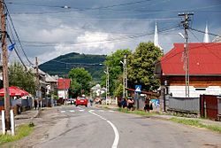 Road passing through the town
 -
 Train station
.JPG)


| International | |
|---|---|
| National | |