


Haiphong
Haiphong
Hải Phòng | |
|---|---|
| City of Haiphong Thành phố Hải Phòng | |
From top, left to right: Haiphong skyline on Cấm River, Lê Chân statue at Haiphong City Exhibition House, Chùa Vẽ Terminal of Haiphong Port, Nguyễn Bỉnh Khiêm crossroad on Lê Hồng Phong Blvd, Haiphong Opera House, Haiphong Central Post, Đồ Sơn Beach | |
 Coat of arms | |
| Nickname: Flamboyant City (Thành phố hoa phượng đỏ) | |
 Provincial location in Vietnam | |
 Interactive map of Haiphong | |
| Coordinates: 20°51′54.5″N 106°41′01.8″E / 20.865139°N 106.683833°E | |
| Country | |
| Region | Red River Delta |
| Seat | Hồng Bàng |
| Subdivision | 45 wards, 67 communes, 2 special zones |
| Government | |
| • Type | Municipality |
| • Body | Haiphong People's Council |
| • Secretary of the City Party Committee | Lê Tiến Châu |
| • Chairman of City People's Council | Lê Văn Hiệu |
| • Chairman of City People's Committee | Lê Ngọc Châu |
| • Chairman of Fatherland Front | Phạm Văn Lập |
| Area | |
| 3,194.72 km2 (1,233.49 sq mi) | |
| Population | |
| 4,664,124 | |
| • Density | 1,459/km2 (3,780/sq mi) |
| • Urban | 2,346,921 |
| Ethnic groups | |
| • Vietnamese | 99.6% |
| • Others | 0.4% |
| GDP (PPP, constant 2015 values) | |
| • Year | 2023 |
| • Total (Metro) | $28.9 billion[5] |
| • Per capita | $20,300 |
| Time zone | UTC+07:00 (ICT) |
| Postal code | 04xxx–05xxx |
| Area codes | 225 |
| ISO 3166 code | VN-HP |
| License plate | 15, 16 |
| HDI (2022) | (4th) |
| Climate | Cwa |
| International airport | Cat Bi International Airport |
| Website | en |

.jpg)


Haiphong or Hai Phong (Vietnamese: Hải Phòng, pronounced [hǎːj fɔ̀ŋ͡m] ⓘ) is the third-largest city in Vietnam and is the principal port city of the Red River Delta.[7] The municipality has an area of 3,194.72 km2 (1,233.49 mi2).[2] The city includes Bạch Long Vĩ and Cát Hải islands in the Gulf of Tonkin. It has a population of 4,664,124 in 2025.[2]
Geography
Haiphong is a coastal city located at the mouth of the Cấm River, in Vietnam's north-eastern coastal area. The Bính Bridge crosses the Cam and connects the city with Thủy Nguyên municipal city.[8] It has a total natural area of 3,194.72 square kilometres or 319,472 hectares. It borders Quảng Ninh Province to the north, Bắc Ninh Province to the northwest, Hưng Yên Province to the southwest, and the Gulf of Tonkin to the east. Bach Long Vi island, Cat Ba Island and the Long Châu islands, located in the Gulf, are also administered as part of the city. Tidal flat ecosystems occur adjacent to the city, some have been reclaimed for agriculture or development purposes.[9]
Climate
Haiphong features a humid subtropical climate (Koppen: Cwa) with hot, humid summers and warm, dry winters. The city is wetter from April through October; roughly 90% of the city's annual rainfall (which totals approximately 1,700 millimetres or 67 inches) typically falls during these months. There is a difference in temperatures between the city's winters and summers. Haiphong's coolest months, January and February, sees average high temperatures reach 20 °C (68 °F) and average low temperatures at around 14 °C (57.2 °F). Its warmest months, June and July, sees average high temperatures hover around 33 °C (91.4 °F) and average low temperatures at around 26 °C (78.8 °F). Sea temperatures range from a low of 21 °C (70 °F) in February to a high of 30 °C (86 °F) during the months of July and August.[10]
| Climate data for Haiphong (Phù Liễn, Kiến An district) | |||||||||||||
|---|---|---|---|---|---|---|---|---|---|---|---|---|---|
| Month | Jan | Feb | Mar | Apr | May | Jun | Jul | Aug | Sep | Oct | Nov | Dec | Year |
| Record high °C (°F) | 31.0 (87.8) |
34.1 (93.4) |
35.4 (95.7) |
37.4 (99.3) |
41.5 (106.7) |
39.5 (103.1) |
38.5 (101.3) |
39.4 (102.9) |
37.4 (99.3) |
36.6 (97.9) |
33.1 (91.6) |
30.0 (86.0) |
41.5 (106.7) |
| Mean daily maximum °C (°F) | 19.8 (67.6) |
20.1 (68.2) |
22.2 (72.0) |
26.4 (79.5) |
30.6 (87.1) |
32.0 (89.6) |
32.1 (89.8) |
31.5 (88.7) |
30.8 (87.4) |
29.0 (84.2) |
25.8 (78.4) |
22.1 (71.8) |
26.9 (80.4) |
| Daily mean °C (°F) | 16.3 (61.3) |
17.0 (62.6) |
19.4 (66.9) |
23.1 (73.6) |
26.6 (79.9) |
28.2 (82.8) |
28.4 (83.1) |
27.8 (82.0) |
26.9 (80.4) |
24.7 (76.5) |
21.5 (70.7) |
18.1 (64.6) |
23.2 (73.8) |
| Mean daily minimum °C (°F) | 14.2 (57.6) |
15.2 (59.4) |
17.7 (63.9) |
21.1 (70.0) |
24.1 (75.4) |
25.6 (78.1) |
25.9 (78.6) |
25.3 (77.5) |
24.3 (75.7) |
22.0 (71.6) |
18.8 (65.8) |
15.5 (59.9) |
20.8 (69.4) |
| Record low °C (°F) | 4.5 (40.1) |
4.5 (40.1) |
6.1 (43.0) |
10.4 (50.7) |
15.5 (59.9) |
18.4 (65.1) |
20.3 (68.5) |
20.4 (68.7) |
15.6 (60.1) |
12.7 (54.9) |
9.0 (48.2) |
4.9 (40.8) |
4.5 (40.1) |
| Average rainfall mm (inches) | 28.0 (1.10) |
27.4 (1.08) |
48.5 (1.91) |
85.3 (3.36) |
201.6 (7.94) |
238.1 (9.37) |
238.1 (9.37) |
353.0 (13.90) |
257.1 (10.12) |
136.3 (5.37) |
43.0 (1.69) |
22.8 (0.90) |
1,679.3 (66.11) |
| Average rainy days | 8.4 | 12.8 | 17.1 | 12.9 | 12.6 | 14.1 | 14.2 | 17.5 | 13.8 | 9.7 | 6.4 | 5.5 | 145.2 |
| Average relative humidity (%) | 84.4 | 88.5 | 90.9 | 90.7 | 87.5 | 86.8 | 86.6 | 88.4 | 86.3 | 82.3 | 79.8 | 79.5 | 86.0 |
| Mean monthly sunshine hours | 82.0 | 46.6 | 41.3 | 85.0 | 183.7 | 181.3 | 199.1 | 169.5 | 179.1 | 179.8 | 148.5 | 126.8 | 1,624.8 |
| Source 1: Vietnam Institute for Building Science and Technology[11] | |||||||||||||
| Source 2: The Yearbook of Indochina (1930-1931)[12] | |||||||||||||
| Month | Jan | Feb | Mar | Apr | May | Jun | Jul | Aug | Sep | Oct | Nov | Dec | Year |
|---|---|---|---|---|---|---|---|---|---|---|---|---|---|
| Average temperature °C (°F) | 22 °C (72 °F) | 21 °C (70 °F) | 22 °C (72 °F) | 24 °C (75 °F) | 27 °C (81 °F) | 29 °C (84 °F) | 30 °C (86 °F) | 30 °C (86 °F) | 29 °C (84 °F) | 28 °C (82 °F) | 26 °C (79 °F) | 23 °C (73 °F) | 26 °C (79 °F) |
History
Dynasties
Haiphong was the home of Lê Chân, one of the female generals under the command of the Trưng Sisters who rose against Chinese domination in 40 AD and ruled until their defeat in 43 AD. Lê Chân was known to have established the Hải tần Phòng thủ (“Defenced Sea-coast”) during the war against general Ma Yuan of the Han dynasty.[13][14]

By the 19th century, at the end of Tự Đức's reign, the Hang Kenh Communal House in what is later the city's Le Chan District was made the administrative seat of An Dương District.[15]
Democratic Republic of Vietnam
Following the defeat of Japan in World War II, Vietnamese nationalists agitated for independence against French return. French forces landed in Haiphong and encountered resistance which resulted in the deaths of three French soldiers. In retaliation, the French ships, among them the cruiser Suffren, shelled the city, setting it ablaze[16] and precipitating the First Indochina War.[17][18] French infantry forces under the command of Jean-Étienne Valluy entered the city, fighting house to house with the support of armored units and airplanes.[19]
In the Vietnam War, Haiphong was subjected to bombing by US Navy and Air Force strike aircraft. U.S. Admiral Thomas H. Moorer ordered the mining of Haiphong harbor on 8 May 1972, effectively sealing the port. Until it was lifted, the mining caused no casualty.[20][21] The physical structure of the city was mostly unaffected by the war as the US had a self-imposed prohibition zone for the city. After the war, the city recovered its role as an industrial center.[15]
Socialist Republic of Vietnam
On 20 February 2025 the Vietnamese parliament approved an $8 billion railroad investment to upgrade under Xi Jinping's Belt and road initiative the old French-built Kunming–Haiphong railway, which serves the Chinese border city Hekou Yao, Lao Cai, Hanoi and Haiphong.[22]
On 12 June 2025, the National Assembly issued Resolution No. 202/2025/QH15[2] on the arrangement of provincial-level administrative units (the resolution took effect on June 12, 2025). Accordingly, Hải Dương Province was merged into Hai Phong City.[23]
Economy
Haiphong is an economic center of the North in particular and Vietnam in general both. Under French domination, Haiphong was level 1 city, equal to Saigon and Hanoi. The last years of the 19th century, the French had proposed to build Haiphong into the economic capital of Indochina.[24]
In 2009, Haiphong state budget revenue reached 34,000 billion Vnd. In 2011, budget revenues in the city reached 47,725 billion, increase 19% compared to 2010.[25] In 2015, total revenues of the city reached 56 288 billion. Government plans that to 2020, Haiphong's revenues will be over 80,000 billion and the domestic revenue reach 20.000 billion. In the ranking of the Provincial Competitiveness Index (PCI) 2013 of Vietnam, Haiphong city ranked at No. 15/63 provinces.[26] Haiphong has relationship of trading goods with more than 40 countries and territories around the world. It is striving to become one of the largest commercial centers of the country.[27] On Vietnam's Provincial Competitiveness Index 2023, a tool for evaluating the business environment in Vietnam’s provinces, Hai Phong received a score of 70.34. This was an improvement from 2022 in which the province received a score of 70.76. In 2023, the province received its highest scores on the 'Labor Policy' and 'Time Costs' criterion and lowest on 'Policy Bias' and ‘Transparency’.[28]
Industry
Industry is a key sector in Haiphong including food processing, light industries and heavy industries. Major products include fish sauce, beer, cigarettes, textiles, paper, plastic pipes, cement, iron, pharmaceuticals, electric fans, motorbikes, steel pipes and ships and out-sourcing software implementation.[29] Most of these industries have been growing more significantly between 2000 and 2007, with the exceptions of the cigarette and pharmaceutical industries. Shipbuilding, steel pipes, plastic pipes and textiles are among the industries with the most rapid growth.[29]
There are also growing industries supplying products used by existing industries in the city. PetroVietnam set up a joint-venture PVTex with textile manufacturer Vinatex to build Vietnam's first polyester fiber plant in Haiphong. The factory will use by-products from oil-refining and reduce reliance on imported materials.[30] 270,600 people were employed in Haiphong's industry. 112,600 industrial jobs were created between 2000 and 2007.[29]
Agriculture, forestry and fishery
Around one third of Haiphong's area or 52,300 ha (as of 2007) are used for agriculture. Rice takes up around 80% of the agricultural land with an output of 463,100 tons in 2007.[29] Other agricultural products include maize, sugar and peanuts.[29]
Haiphong has a fishing sector with an output of 79,705 tons (2007). Gross output has almost doubled between 2000 and 2007, mostly due to growth in aquaculture, which made up 60% of gross output in 2007. Sea fish contribute around one fourth to the sector.[29]
As of 2007, 315,500 were employed in agriculture and fishery, a decrease from 396,300 in 2000. These sectors still account for almost a third of total employment in Haiphong, a larger share than industry.[29]
Demographics
Haiphong is the third most populous city in Vietnam, with a population of 2.103.500 for the metropolitan area (2015), encompassing an area of 1,507.57 km2 (582.08 sq mi), 46,1% of population reside in the urban districts.[31] The gender distribution is half female (50.4%).[32]
As of the 2009 census, Haiphong's average annual population growth rate was given as 4.0%. Haiphong's crude birth rate was recorded at 18.1 live births per 1000 persons vs the crude death rate of 7.6 per 1000 persons. Life expectancy at birth was estimated at 77.1 years for women and 72.0 years for men, or 74.5 years overall. Infant mortality rate was measured at 11.8 infant deaths per 1000 live births, over two points above the nation's average for urban areas. In the same census, the city's out-migration was 1.9% vs in-migration of 2.8% and, for a net migration rate of 0.9%.[32]
Transport

Haiphong is located at the junction of two National Highways: Route 5, leading west to Hanoi, and Route 10, leading south to Nam Định and onward to connect with National Route 1 at Ninh Bình. Highway 356 passes west–east from the Route 5/10 junction through Haiphong's city center all the way to the coast. A connecting road from route 5 to route 18 links Haiphong with Quảng Ninh Province. In 2015, the new highway connecting Haiphong with Hanoi was completed; this reduces the trip by one hour as compared to the previous route.[33]

The Port of Haiphong on the Cấm River is divided into three main docks: Hoang Dieu (Central terminal) located near the city's center, Chua Ve, and Dinh Vu both farther downstream to the east.[34]
Twin towns
Gallery
-
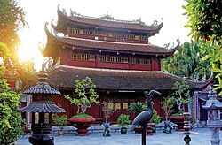 Du Hang Pagoda
 -
 Du Hang Pagoda architecture
 -
 The city's Opera House
 -
 A Buddhist temple in Haiphong.
 -
 Haiphong Cathedral (2007)
 -
 Haiphong City International Exhibition Center


.jpg)


References
- ^ Biểu số 4.2: Hiện trạng sử dụng đất vùng Đồng Bằng Sông Hồng năm 2022 [Table 4.2: Current land use status in the Red River Delta in 2022] (PDF) (Decision 3048/QĐ-BTNMT) (in Vietnamese). Ministry of Natural Resources and Environment (Vietnam). 18 October 2023. – the data in the report are in hectares, rounded to integers
- ^ a b c d e "Nghị quyết số 202/2025/QH15 về việc sắp xếp đơn vị hành chính cấp tỉnh" [Resolution No. 202/2025/QH15 on the arrangement of provincial-level administrative units]. National Assembly of Vietnam Portal. 2025-06-12. Archived from the original on 2025-06-12. Retrieved 2025-06-12.
- ^ General Statistics Office of Vietnam (2023). Niên giám Thống kê Việt Nam năm 2022 [Statistical Yearbook of Vietnam 2022] (PDF). Statistical Publishing House (Vietnam). p. 105. Archived (PDF) from the original on 2024-04-03. Retrieved 2024-04-03.
- ^ General Statistics Office of Vietnam (2019). "Completed Results of the 2019 Viet Nam Population and Housing Census" (PDF). Statistical Publishing House (Vietnam). ISBN 978-604-75-1532-5.
- ^ "TelluBase—Viet Nam Fact Sheet" (PDF). Tellusant Public Service Series. Retrieved 31 July 2024.
- ^ "Human Development Index by province(*) by Cities, provincies and Year". General Statistics Office of Vietnam. Retrieved September 28, 2024.
- ^ "DEEP C - Living and Working in Vietnam". Archived from the original on 2020-06-25. Retrieved 2020-06-22.
- ^ "Vị trí địa lý thành phố Hải Phòng" [The Geographical Location of Hai Phong City”]. Cổng thông tin điện tử Thành phố Hải Phòng (in Vietnamese). 26 February 2025. Retrieved 24 November 2025.
- ^ Murray, N.J.; Clemens, R.S.; Phinn, S.R.; Possingham, H.P.; Fuller, R.A. (2014). "Tracking the rapid loss of tidal wetlands in the Yellow Sea" (PDF). Frontiers in Ecology and the Environment. 12 (5): 267–272. Bibcode:2014FrEE...12..267M. doi:10.1890/130260.
- ^ a b "Haiphong Climate Guide, Vietnam". WorldWeatherGuide.co.uk. Retrieved 2025-11-28.
- ^ "Vietnam Institute for Building Science and Technology" (PDF).
- ^ The Yearbook of Indochina (1930-1931)
- ^ "Nữ tướng Lê Chân và dấu ấn Hải Tần Phòng Thủ" [General Lê Chân and the Mark of the Hải Tần Defense]. anhp.vn. Retrieved 2025-11-28.
- ^ "Chương trình Famtrip"Hải tần Phòng thủ - Góc nhìn mới" tiếp tục giới thiệu nhiều địa danh lịch sử và ẩm thực Hải Phòng | Cổng Thông tin điện tử thành phố Hải phòng". Archived from the original on 2023-07-19. Retrieved 2025-11-28.
- ^ a b "About Hai Phong". www.haiphongtourism.gov.vn. Archived from the original on 2017-06-29. Retrieved 2025-11-28.
- ^ Vietnam by Spencer C. Tucker, page 47. "On 23 November DebeS delivered an ultimatum to the Vietnamese at Haiphong, ordering them to withdraw from the French section of the city, the Chinese quarter, and the port. He gave them only two hours to reply. When the time was up the French subjected the Vietnamese positions to air, land, and sea bombardment, the bulk of the firepower coming from the three- and eight-inch guns of the French Navy Cruiser Suffren. Only military targets were destroyed and not the Vietnamese quarter as some have claimed. Estimates of the number killed in the shelling and ensuing panic vary widely. Casualties up to 20,000 have been cited. French Admiral Battet later said that no more than 6,000 Vietnamese had died, but in 1981 Vu Quoc Uy, then chairman of the Haiphong municipal committee, told Stanley Karnow that the figure was only 500 to 1,000 dead. Others have put the figure as low as 200".
- ^ (in French) Maurice Vaïsse, L'Armée française dans la guerre d'Indochine (1946–1954) : Adaptation ou inadaptation, 2000, p. 276
- ^ Plon, Le General de Gaulle et l'Indochine 1940–1946, page 210. "In connection with the naval bombardment, let us note that only the ships of small tonnage could go up the river of Haiphong. On November 23, two colonial sloops supported for the first time the French troops with their artillery to a limited effect: the Chevreuil with its double turret, with its two pairs of 100mm, Savorgnan de Brazza with its four turrets each of one 138mm. No battleship was present. On November 27 on that the evening, the cruiser Suffren was in the Bay d' Along, its tidal water prohibiting it access of the Cua Cam. It transported troops in reinforcement..."
- ^ Phillippe Devillers, Histoire du Viêt-Nam de 1940 à 1952. Editions du Seuil, Paris. Third edition,1952, pp. 331–340
- ^ "WGBH Open Vault - Interview with Thomas H. Moorer, 1981". openvault.wgbh.org. Archived from the original on 2016-03-04. Retrieved 2025-11-28.
- ^ Forbes, Andrew, and Henley, David: Vietnam Past and Present: The North (History and culture of Hanoi and Tonkin). Chiang Mai. Cognoscenti Books, 2012. ASIN: B006DCCM9Q.
- ^ "Vietnam parliament approves $8 billion rail link to China". Yahoo News. Archived from the original on 2025-02-21. Retrieved 2025-11-28.
- ^ Tống Thoan (10 June 2025). "Sáp nhập Hải Phòng và Hải Dương: Mở rộng không gian phát triển, phát huy vai trò dẫn dắt của các vùng động lực" [Merging Hải Phòng and Hải Dương: Expanding Development Space and Enhancing the Leading Role of Key Economic Regions]. Báo Quốc Tế (in Vietnamese). Retrieved 17 November 2025.
- ^ "Liên kết phát triển giữa Hà Nội và Hải Phòng đóng vai trò quan trọng" [The Development Linkage between Hanoi and Hai Phong Plays an Important Role]. Archived from the original on 2011-09-05. Retrieved 2016-03-07.
- ^ "Tin Bộ Tài Chính". Bộ Tài Chính (in Vietnamese). Retrieved 9 May 2025.
- ^ "General Ranking". www.pcivietnam.org. Retrieved 2017-09-14.
{{cite web}}: CS1 maint: deprecated archival service (link) - ^ "Hai Phong: Ambitious Targets for FDI Attraction". Hai Phong News. Hai Phong People's Committee. Retrieved 26 February 2026.
- ^ the-shiv (2024-08-17). "Doing Business in Hai Phong, Vietnam 2024". the-shiv. Retrieved 2025-11-28.
- ^ a b c d e f g General Statistics Office (2009): Socio-economic Statistical Data of 63 Provinces and Cities, Vietnam. Statistical Publishing House, Hanoi
- ^ "Saigon Times Online - PVTex to operate first polyester fiber project early 2011 - PVTex to operate first polyester fiber project early 2011". english.thesaigontimes.vn. Archived from the original on 2011-10-06. Retrieved 2025-11-28.
- ^ Bureau of East Asian and Pacific Affairs (May 27, 2010). "Background Note: Vietnam". U.S. Department of State. Retrieved 2010-06-21.
- ^ a b "The 2009 Vietnam Population and Housing census: Major findings". www.gso.gov.vn. Archived from the original on 2025-09-15. Retrieved 2025-11-28.
- ^ "Thời tiết hải phòng". Retrieved 2025-11-28.
- ^ "Haiphong Port: Maps". Archived from the original on 2011-08-21. Retrieved 2011-04-09.
- ^ "Hải Phòng và Đà Nẵng hợp tác phát triển toàn diện". VOV.VN (in Vietnamese). Đài Tiếng nói Việt Nam. 2022-04-01. Retrieved 2026-02-26.
- ^ ""Sister Cities & Affiliated Cities"". incheon.go.kr. Incheon Metropolitan City. Retrieved 2021-01-08.
- ^ "DEEP C shakes hand with City of Kitakyushu to promote investment". deepc.vn. DEEP C Industrial Zones. 2019-05-13. Retrieved 2021-01-07.[permanent dead link]
- ^ "Il canale dei Navicelli, la via d'acqua tra Pisa e Livorno ponte per un gemellaggio?". pressmare.it (in Italian). Press Mare. 2016-02-24. Retrieved 2021-01-07.
- ^ "Il 南宁市国际友城名单及分布图". nanning.gov.cn (in Chinese). Naning. Archived from the original on 2020-07-11. Retrieved 2020-07-11.
- ^ ""Международные и межрегиональные связи"". gov.spb.ru (in Russian). Federal city of Saint Petersburg. Retrieved 2020-11-12.
- ^ "Seattle's Sister Cities". City of Seattle. Archived from the original on 2022-02-25. Retrieved 2021-09-16.
- ^ "天津友好城市一览表". tj.gov.cn (in Chinese). Tianjin. Retrieved 2021-01-07.
Notes
External links
- Official Website of Haiphong City
- Official Website of Haiphong Tourism.
- History of Haiphong: interactive Google Map with specific sites and historic views of the city from French colonial times.
| International | |
|---|---|
| National | |
| Geographic | |
| Other | |

Places adjacent to Haiphong | |
|---|---|