


Size of this preview: 613 × 600 pixels. Other resolutions: 245 × 240 pixels | 491 × 480 pixels | 785 × 768 pixels | 1,046 × 1,024 pixels | 2,093 × 2,048 pixels | 6,013 × 5,884 pixels.
Original file (6,013 × 5,884 pixels, file size: 4.89 MB, MIME type: image/png)
Summary
| Description |
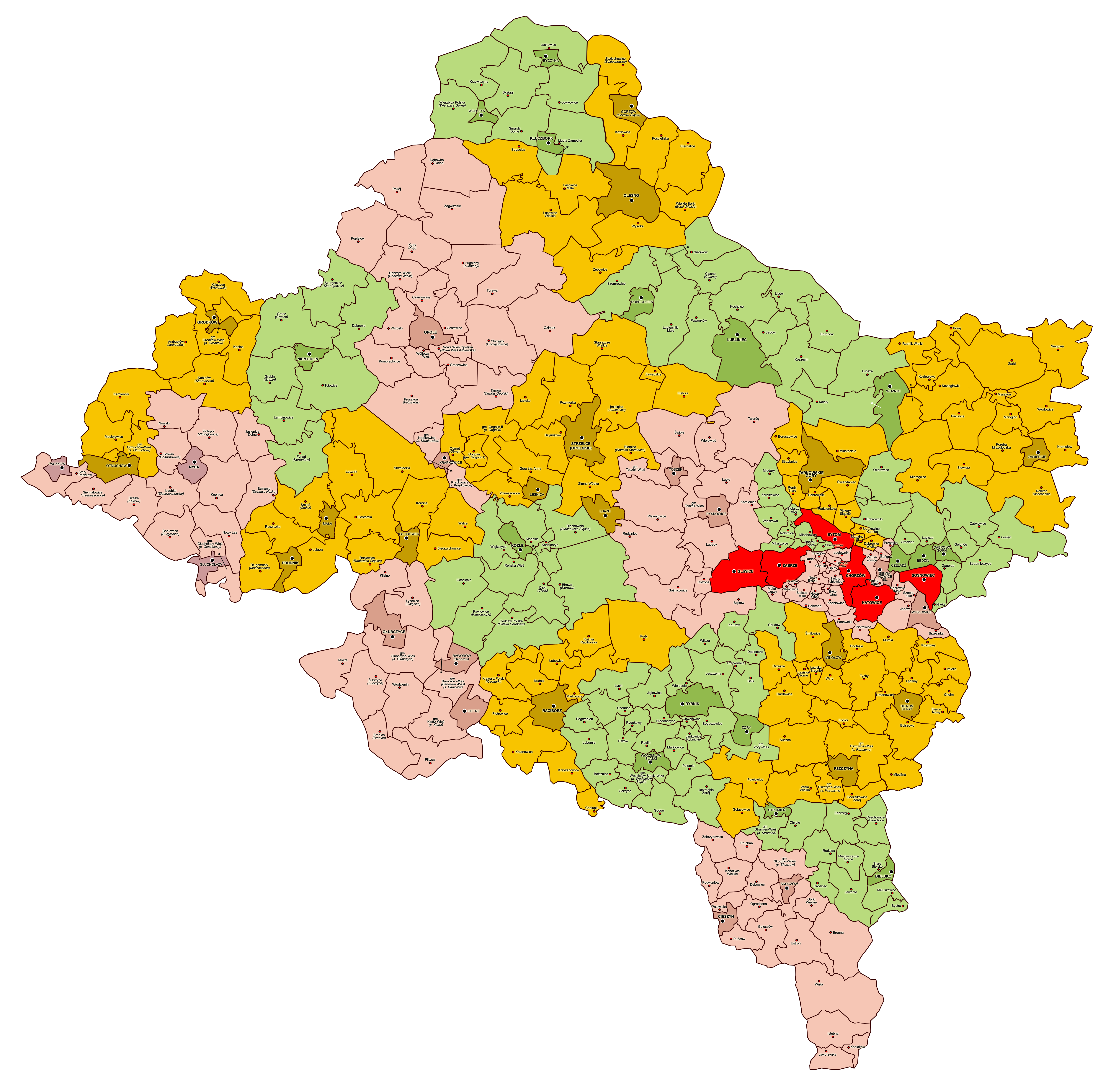
Polski: Mapa administracyjna województwa śląskiego, stan na rok 1946, z zaznaczonymi powiatami i gminami zbiorowymi. Gminy miejskie oznaczone kolorem ciemnym. Powiaty grodzkie oznaczone kolorem czerwonym.
English: Administrative map of Silesian Voivodeship as of 1946, with marked poviats (counties) and gminas (municipalities). Urban gminas depicted in dark shade. City poviats depicted in red color. |
| Date | |
| Source | Own work |
| Author | Qqerim |
Licensing
I, the copyright holder of this work, hereby publish it under the following license:
This file is licensed under the Creative Commons Attribution 3.0 Unported license.
- You are free:
- to share – to copy, distribute and transmit the work
- to remix – to adapt the work
- Under the following conditions:
- attribution – You must give appropriate credit, provide a link to the license, and indicate if changes were made. You may do so in any reasonable manner, but not in any way that suggests the licensor endorses you or your use.
File history
Click on a date/time to view the file as it appeared at that time.
| Date/Time | Thumbnail | Dimensions | User | Comment | |
|---|---|---|---|---|---|
| current | 20:26, 23 February 2019 | | 6,013 × 5,884 (4.89 MB) | Qqerim | User created page with UploadWizard |
File usage
The following page uses this file:
Global file usage
The following other wikis use this file:
- Usage on de.wikipedia.org
- Usage on pl.wikipedia.org


You must be logged in to post a comment.