


Size of this preview: 800 × 413 pixels. Other resolutions: 320 × 165 pixels | 640 × 331 pixels | 1,024 × 529 pixels | 1,500 × 775 pixels.
Original file (1,500 × 775 pixels, file size: 116 KB, MIME type: image/png)
Summary
| Description |
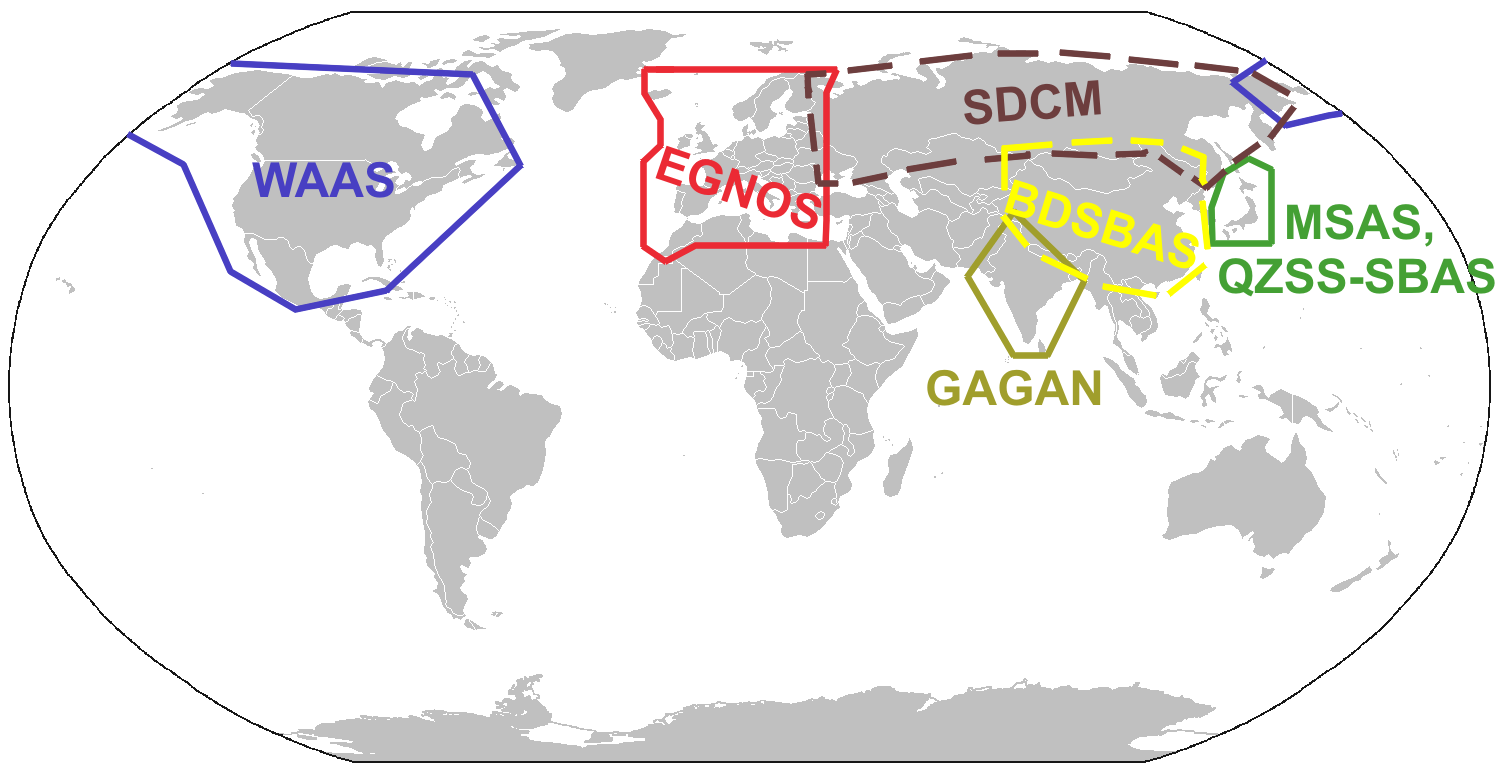
English: Service Areas of Satellite Based Augmentation Systems (SBAS) |
| Date | |
| Source | Own work. Almost identical to a map in Refinement of Broadcast Integrity Methods for Space Based Augmentation System Selection (https://www.ion.org/publications/abstract.cfm?articleID=12639, subscription required) |
| Author | Persimplex |
Licensing
I, the copyright holder of this work, hereby publish it under the following license:
This file is licensed under the Creative Commons Attribution-Share Alike 3.0 Unported license.
- You are free:
- to share – to copy, distribute and transmit the work
- to remix – to adapt the work
- Under the following conditions:
- attribution – You must give appropriate credit, provide a link to the license, and indicate if changes were made. You may do so in any reasonable manner, but not in any way that suggests the licensor endorses you or your use.
- share alike – If you remix, transform, or build upon the material, you must distribute your contributions under the same or compatible license as the original.
File history
Click on a date/time to view the file as it appeared at that time.
| Date/Time | Thumbnail | Dimensions | User | Comment | |
|---|---|---|---|---|---|
| current | 10:00, 4 January 2018 | | 1,500 × 775 (116 KB) | Persimplex | updated 2018 |
| 06:36, 4 April 2012 |  | 1,500 × 775 (104 KB) | Persimplex |
File usage
The following 5 pages use this file:
Global file usage
The following other wikis use this file:
- Usage on af.wikipedia.org
- Usage on ca.wikipedia.org
- Usage on de.wikipedia.org
- Usage on es.wikipedia.org
- Usage on eu.wikipedia.org
- Usage on fi.wikipedia.org
- Usage on fr.wikipedia.org
- Usage on id.wikipedia.org
- Usage on it.wikipedia.org
- Usage on ja.wikipedia.org
- Usage on lv.wikipedia.org
- Usage on ml.wikipedia.org
- Usage on pnb.wikipedia.org
- Usage on ro.wikipedia.org
- Usage on ru.wikipedia.org
- Usage on sv.wikipedia.org
- Usage on ur.wikipedia.org
- Usage on zh.wikipedia.org
You must be logged in to post a comment.