


Size of this preview: 488 × 600 pixels. Other resolutions: 195 × 240 pixels | 391 × 480 pixels | 625 × 768 pixels | 1,040 × 1,278 pixels.
Original file (1,040 × 1,278 pixels, file size: 360 KB, MIME type: image/jpeg)
| Description |
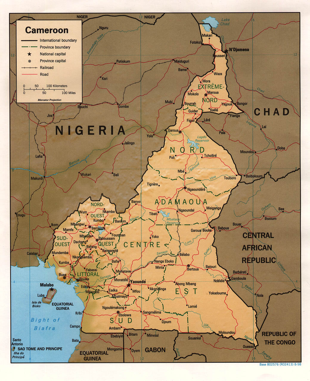
English: Shaded relief map of Cameroon. |
|||
| Date | ||||
| Source | [1] from the Perry-Castañeda Library Map Collection. | |||
| Author | CIA | |||
| Permission (Reusing this file) |
|

![[1]](http://www.lib.utexas.edu/maps/africa/cameroon_rel98.jpg)
File history
Click on a date/time to view the file as it appeared at that time.
| Date/Time | Thumbnail | Dimensions | User | Comment | |
|---|---|---|---|---|---|
| current | 11:41, 21 February 2006 | | 1,040 × 1,278 (360 KB) | Lupo | Shaded relief map of Cameroon. Source: [http://www.lib.utexas.edu/maps/africa/cameroon_rel98.jpg] from the [http://www.lib.utexas.edu/maps/cameroon.html Perry-Castañeda Library Map Collection]. {{PD-USGov-CIA}} Category:Maps of Cameroon |
File usage
The following 4 pages use this file:
Global file usage
The following other wikis use this file:
- Usage on ar.wikipedia.org
- Usage on az.wikipedia.org
- Usage on ba.wikipedia.org
- Usage on cv.wikipedia.org
- Usage on fa.wikipedia.org
- Usage on hr.wiktionary.org
- Usage on ig.wikipedia.org
- Usage on it.wikipedia.org
- Usage on ka.wikipedia.org
- Usage on lv.wikipedia.org
- Usage on pl.wikipedia.org
- Usage on ru.wikipedia.org
- Usage on sv.wikipedia.org
- Usage on uk.wikipedia.org
- Usage on vec.wikipedia.org
- Usage on vi.wikipedia.org
- Usage on wo.wikipedia.org
- Usage on zh.wikipedia.org
You must be logged in to post a comment.