


Size of this preview: 800 × 323 pixels. Other resolutions: 320 × 129 pixels | 640 × 258 pixels | 1,771 × 714 pixels.
Original file (1,771 × 714 pixels, file size: 394 KB, MIME type: image/png)
Summary
| Description |
|
| Date |
before 19 September 2005 |
| Source |
Own work |
| Author |
Tschubby |

|
This map image could be re-created using vector graphics as an SVG file. This has several advantages; see Commons:Media for cleanup for more information. If an SVG form of this image is available, please upload it and afterwards replace this template with
{{vector version available|new image name}}.
It is recommended to name the SVG file “Karte Hochrhein.svg”—then the template Vector version available (or Vva) does not need the new image name parameter. |
Licensing
- Licence:

|
Permission is granted to copy, distribute and/or modify this document under the terms of the GNU Free Documentation License, Version 1.2 or any later version published by the Free Software Foundation; with no Invariant Sections, no Front-Cover Texts, and no Back-Cover Texts. A copy of the license is included in the section entitled GNU Free Documentation License. |
| This file is licensed under the Creative Commons Attribution-Share Alike 3.0 Unported license. | ||
| ||
| This licensing tag was added to this file as part of the GFDL licensing update. |
File history
Click on a date/time to view the file as it appeared at that time.
| Date/Time | Thumbnail | Dimensions | User | Comment | |
|---|---|---|---|---|---|
| current | 14:22, 2 March 2018 | 1,771 × 714 (394 KB) | Tschubby | {{Information |description= |source= |date= |author= |permission= |other versions= }} | |
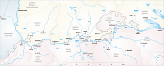
| 19:50, 19 September 2005 | 1,771 × 714 (416 KB) | Tschubby | *Description: Hochrhein *Designer: Tschubby *Licence: {{GFDL}} Category:Maps of Swiss river |
File usage
The following 5 pages use this file:
Global file usage
The following other wikis use this file:
- Usage on als.wikipedia.org
- Usage on ar.wikipedia.org
- Usage on da.wikipedia.org
- Usage on de.wikipedia.org
- Usage on de.wikivoyage.org
- Usage on de.wiktionary.org
- Usage on eo.wikipedia.org
- Usage on es.wikipedia.org
- Usage on fr.wikipedia.org
- Usage on ko.wikipedia.org
- Usage on nn.wikipedia.org
- Usage on ro.wikipedia.org
- Usage on sl.wikipedia.org
- Usage on ta.wikipedia.org
- Usage on tr.wikipedia.org
- Usage on uk.wikipedia.org
- Usage on www.wikidata.org