


Size of this preview: 799 × 102 pixels. Other resolutions: 320 × 41 pixels | 640 × 82 pixels | 1,024 × 131 pixels | 1,280 × 163 pixels | 12,756 × 1,629 pixels.
Original file (12,756 × 1,629 pixels, file size: 2.11 MB, MIME type: image/jpeg)
Summary
| Description |
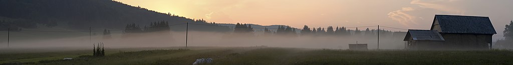
Slovenščina: Mrak pade na Bloško planoto |
| Date | |
| Source | Own work |
| Author | Mihael Grmek |
| Camera location | | View this and other nearby images on: OpenStreetMap |
|---|
Licensing
I, the copyright holder of this work, hereby publish it under the following licenses:
This file is licensed under the Creative Commons Attribution-Share Alike 3.0 Unported license.
- You are free:
- to share – to copy, distribute and transmit the work
- to remix – to adapt the work
- Under the following conditions:
- attribution – You must give appropriate credit, provide a link to the license, and indicate if changes were made. You may do so in any reasonable manner, but not in any way that suggests the licensor endorses you or your use.
- share alike – If you remix, transform, or build upon the material, you must distribute your contributions under the same or compatible license as the original.

|
Permission is granted to copy, distribute and/or modify this document under the terms of the GNU Free Documentation License, Version 1.2 or any later version published by the Free Software Foundation; with no Invariant Sections, no Front-Cover Texts, and no Back-Cover Texts. A copy of the license is included in the section entitled GNU Free Documentation License. |
You may select the license of your choice.
File history
Click on a date/time to view the file as it appeared at that time.
| Date/Time | Thumbnail | Dimensions | User | Comment | |
|---|---|---|---|---|---|
| current | 21:50, 25 January 2012 | 12,756 × 1,629 (2.11 MB) | Meho29 | Cropped on the right side, Contrast correction | |
| 11:48, 27 January 2009 | 12,777 × 1,632 (2.2 MB) | Meho29 | {{Information |Description={{sl|1=Mrak pade na Bloško planoto}} |Source=Own work by uploader |Author=Meho29 |Date=2008-08-02 |Permission= |other_versions= }} <!--{{ImageUpload|full}}--> Category:Bloke Category:Panoramics [[Catego |
File usage
The following page uses this file:
Global file usage
The following other wikis use this file:
- Usage on bs.wikipedia.org
- Usage on sco.wikipedia.org
- Usage on sl.wikipedia.org
- Usage on vi.wikipedia.org