


Size of this preview: 800 × 313 pixels. Other resolutions: 320 × 125 pixels | 640 × 250 pixels | 1,024 × 400 pixels | 2,147 × 839 pixels.
Original file (2,147 × 839 pixels, file size: 3.02 MB, MIME type: image/png)
Summary
| Description |
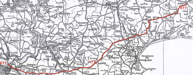
English: Original route of the A477 road as shown in the 1923 Ordnance Survey Ministry of Transport road map.
This image has been modified from the original scan to highlight the A477 road by converting other roads from colour to greyscale. |
| Date | |
| Source | Ministry of Transport Road Map 1923 Sheet 20 |
| Author | Ordnance Survey |
Licensing
This work created by the United Kingdom Government is in the public domain.
This is because it is one of the following:
HMSO has declared that the expiry of Crown Copyrights applies worldwide (ref: HMSO Email Reply)
|
 |
File history
Click on a date/time to view the file as it appeared at that time.
| Date/Time | Thumbnail | Dimensions | User | Comment | |
|---|---|---|---|---|---|
| current | 14:52, 1 May 2017 | 2,147 × 839 (3.02 MB) | Pembs99 | Straighten image | |
| 14:46, 1 May 2017 | 2,151 × 887 (2.93 MB) | Pembs99 | User created page with UploadWizard |
File usage
The following page uses this file: