


File:NPS american-samoa-context-map.jpg
No higher resolution available.
NPS_american-samoa-context-map.jpg (471 × 471 pixels, file size: 40 KB, MIME type: image/jpeg)

|
This map image could be re-created using vector graphics as an SVG file. This has several advantages; see Commons:Media for cleanup for more information. If an SVG form of this image is available, please upload it and afterwards replace this template with
{{vector version available|new image name}}.It is recommended to name the SVG file “NPS american-samoa-context-map.svg”—then the template Vector version available (or Vva) does not need the new image name parameter. |
Summary
| Description |
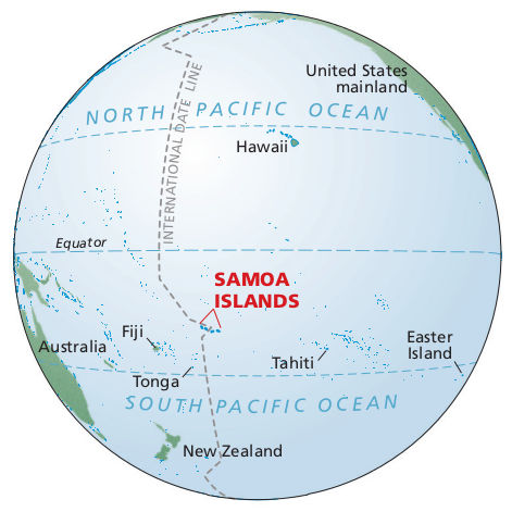
English: Pacific ocean map showing where American Samoa is in relation to the Equator, Fiji, Tahiti, Tonga, Hawaii, and the U.S. mainland – way out there in the Pacific Ocean. |
| Date | |
| Source | American Samoa National Park Maps (https://npmaps.com/american-samoa) |
| Author | U.S. National Park Service, restoration/cleanup by National Park Maps (https://npmaps.com) |
Licensing
| This image or media file contains material based on a work of a National Park Service employee, created as part of that person's official duties. As a work of the U.S. federal government, such work is in the public domain in the United States. See the NPS website and NPS copyright policy for more information. |
File history
Click on a date/time to view the file as it appeared at that time.
| Date/Time | Thumbnail | Dimensions | User | Comment | |
|---|---|---|---|---|---|
| current | 18:35, 13 May 2017 | | 471 × 471 (40 KB) | RKBot | =={{int:filedesc}}== {{Information |description= {{en|1=Pacific ocean map showing where American Samoa is in relation to the Equator, Fiji, Tahiti, Tonga, Hawaii, and the U.S. mainland – way out there in the Pacific Ocean.}} |date= 2016-02-22 |source... |
File usage
The following 3 pages use this file:
Global file usage
The following other wikis use this file:
- Usage on el.wikipedia.org
- Usage on si.wikipedia.org
- Usage on te.wikipedia.org