


Doyleville, Colorado
Doyleville, Colorado | |
|---|---|
 Doyleville and Highway 50 | |
 Doyleville Location of Doyleville, Colorado.  Doyleville Doyleville (Colorado) | |
| Coordinates: 38°27′06″N 106°36′34″W / 38.4517°N 106.6095°W[2] | |
| Country | United States |
| State | Colorado |
| County | Gunnison[1] |
| Established | 1876 |
| Named after | Henry Doyle[3] |
| Government | |
| • Type | unincorporated community |
| • Body | Gunnison County[1] |
| Elevation | 8,055 ft (2,455 m) |
| Time zone | UTC−07:00 (MST) |
| • Summer (DST) | UTC−06:00 (MDT) |
| ZIP code[4] | Gunnison 81230 |
| Area codes | 970/748 |
| GNIS place ID | 204761 |
Doyleville is an unincorporated community located in the governed by Gunnison County, Colorado, United States. It is located 19 miles (31 km) east of Gunnison on U.S. Highway 50.
History
Doyleville is named after Henry Doyle who, along with his wife Susan and their children,[5] homesteaded 160 acres along Tomichi Creek in 1876. The settlement became a stop for the Barlow and Sanderson stage, and a train station was later established with the arrival of Denver and Rio Grande Railroad in the summer of 1881. The Doyleville station allowed area ranchers to ship hay and livestock by rail to markets east over the Continental Divide. The station also became active with passengers traveling to and from nearby Waunita Hot Springs. The Doyleville, Colorado, post office operated from October 24, 1881, until April 4, 1969.[6] The Gunnison, Colorado, post office (ZIP code 81230) now serves the area.[4]
Activity in Doyleville greatly diminished when the Denver and Rio Grande Railroad discontinued passenger service in 1940 and completely abandoned the line in 1955. The school was closed in 1966 and the post office was closed in 1969.[6][7]
In its early years this settlement or its train station briefly assumed various names included Doyle, Doylestown, Gilman, and Hot Springs.[8]
See also
References
- ^ a b "Colorado Counties". Colorado Department of Local Affairs. Retrieved October 16, 2025.
- ^ a b "Doyleville, Colorado". Geographic Names Information System. United States Geological Survey, United States Department of the Interior. Retrieved October 16, 2025.
- ^ Dawson, John Frank. Place names in Colorado: why 700 communities were so named, 150 of Spanish or Indian origin. Denver, CO: The J. Frank Dawson Publishing Co. p. 18.
- ^ a b "ZIP Code Lookup". United States Postal Service. Retrieved October 16, 2025.
- ^ "Henry Doyle", United States census, 1880; Tomichi, Gunnison, Colorado; page 2, line 7, enumeration district 52, National Archives film number T9. Retrieved on 2020-05-04.
- ^ a b Bauer, William H.; Ozment, James L.; Willard, John H. (1990). Colorado Post Offices 1859–1989. Golden, Colorado: Colorado Railroad Historical Foundation. ISBN 0-918654-42-4.
- ^ "Schools". Gunnison County Historic Preservation Commission. Retrieved May 4, 2020.
- ^ Elliott, Donald R.; Elliott, Doris L. Place Names of Colorado (PDF). Denver, Colorado: Colorado Council of Genealogical Societies, Inc.
External links
- State of Colorado
- Barlow & Sanderson Company – Staging in the Mountains Legends of America.
- D&RGW train nearing the Doyleville station from the east. Photo by Otto Perry.
Municipalities and communities of Gunnison County, Colorado, United States | ||
|---|---|---|
| City | 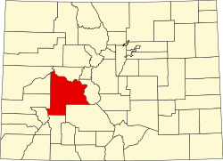 | |
| Towns | ||
| CDP | ||
| Unincorporated communities | ||
| Ghost towns | ||