


File:Wismut location map.jpg

Size of this preview: 800 × 542 pixels. Other resolutions: 320 × 217 pixels | 640 × 433 pixels | 1,024 × 693 pixels | 1,280 × 867 pixels | 2,906 × 1,968 pixels.
Original file (2,906 × 1,968 pixels, file size: 1.05 MB, MIME type: image/jpeg)
Summary

|
This map image could be re-created using vector graphics as an SVG file. This has several advantages; see Commons:Media for cleanup for more information. If an SVG form of this image is available, please upload it and afterwards replace this template with
{{vector version available|new image name}}.It is recommended to name the SVG file “Wismut location map.svg”—then the template Vector version available (or Vva) does not need the new image name parameter. |
| Description |
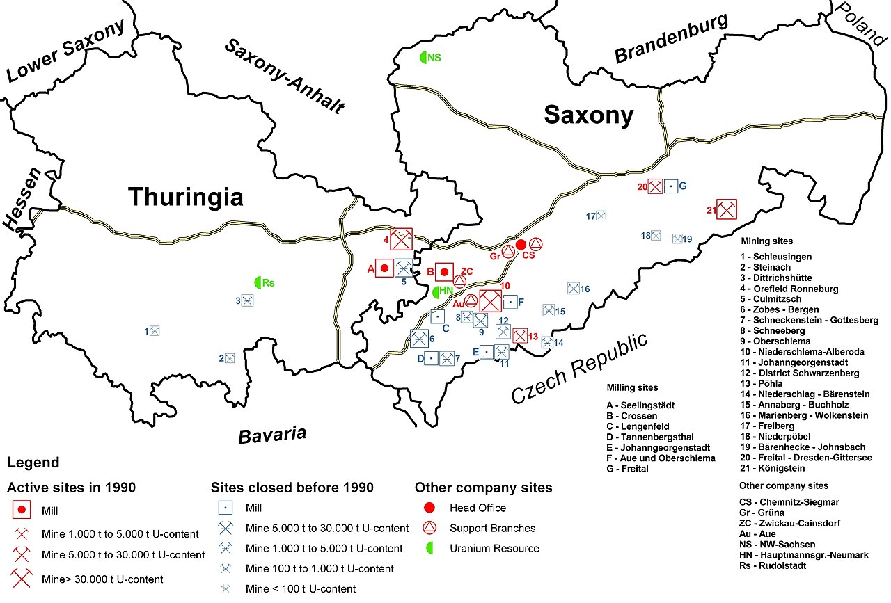
English: Locations of the Wismut uranium mining company in Saxony and Thuringia, Germany |
| Date | |
| Source | Own work |
| Author | Geomartin |
Licensing
I, the copyright holder of this work, hereby publish it under the following licenses:
This file is licensed under the Creative Commons Attribution-Share Alike 3.0 Unported license.
- You are free:
- to share – to copy, distribute and transmit the work
- to remix – to adapt the work
- Under the following conditions:
- attribution – You must give appropriate credit, provide a link to the license, and indicate if changes were made. You may do so in any reasonable manner, but not in any way that suggests the licensor endorses you or your use.
- share alike – If you remix, transform, or build upon the material, you must distribute your contributions under the same or compatible license as the original.

|
Permission is granted to copy, distribute and/or modify this document under the terms of the GNU Free Documentation License, Version 1.2 or any later version published by the Free Software Foundation; with no Invariant Sections, no Front-Cover Texts, and no Back-Cover Texts. A copy of the license is included in the section entitled GNU Free Documentation License. |
You may select the license of your choice.
File history
Click on a date/time to view the file as it appeared at that time.
| Date/Time | Thumbnail | Dimensions | User | Comment | |
|---|---|---|---|---|---|
| current | 16:48, 13 July 2021 | | 2,906 × 1,968 (1.05 MB) | Ras67 | losslessly cropped with Jpegcrop |
| 04:28, 27 December 2008 |  | 2,922 × 2,068 (1.34 MB) | Geomartin | {{Information |Description={{en|1=Locations of the Wismut uranium mining company in Saxony and Thuringia, Germany}} |Source=Own work |Author=Geomartin |Date=december 2008 |Permission= |other_versions= }} <!--{{ImageUpload|full}}--> |
File usage
The following 3 pages use this file:
Global file usage
The following other wikis use this file:
- Usage on ar.wikipedia.org
- Usage on de.wikipedia.org
- Usage on el.wikipedia.org
- Usage on es.wikipedia.org
- Usage on fr.wikipedia.org
- Usage on he.wikipedia.org
- Usage on ru.wikipedia.org
- Usage on vi.wikipedia.org
- Usage on www.wikidata.org