


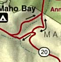
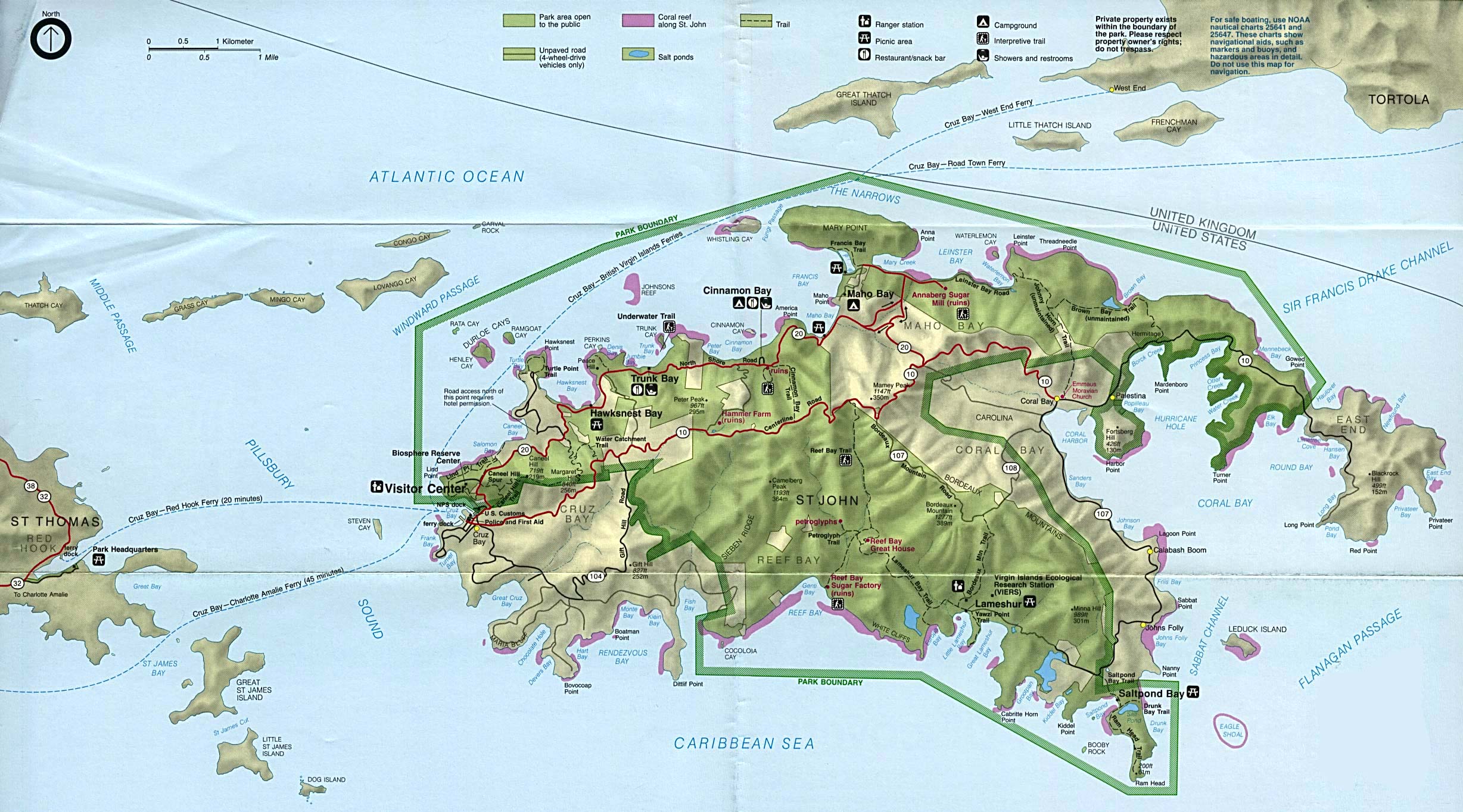
File:VI Highway 20 Configuration.png
No higher resolution available.
VI_Highway_20_Configuration.png (126 × 128 pixels, file size: 47 KB, MIME type: image/png)
Summary
| Description |
English: A map of the configuration of the eastern portion of US Virgin Islands Highway 20. |
| Date | |
| Source | http://www.lib.utexas.edu/maps/national_parks/virgin_island_map.jpg |
| Author | National Park Service |
Licensing
| This image or media file contains material based on a work of a National Park Service employee, created as part of that person's official duties. As a work of the U.S. federal government, such work is in the public domain in the United States. See the NPS website and NPS copyright policy for more information. |
File history
Click on a date/time to view the file as it appeared at that time.
| Date/Time | Thumbnail | Dimensions | User | Comment | |
|---|---|---|---|---|---|
| current | 03:35, 8 April 2013 | | 126 × 128 (47 KB) | A Texas Historian | User created page with UploadWizard |
File usage
The following page uses this file: