


File:Bostonharbourtopomap.png
Size of this preview: 800 × 458 pixels. Other resolutions: 320 × 183 pixels | 640 × 367 pixels | 1,278 × 732 pixels.
Original file (1,278 × 732 pixels, file size: 2.19 MB, MIME type: image/png)
Summary
| Description |
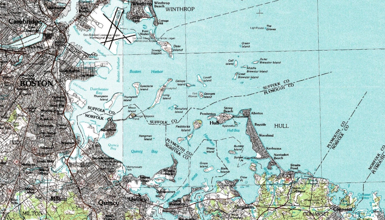
English: Topographical map of Boston Harbour. Captured from NASA World Wind, map by USGS. |
| Source | USGS |
| Author | USGS |
Licensing
This image is in the public domain in the United States because it only contains materials that originally came from the United States Geological Survey, an agency of the United States Department of the Interior. For more information, see the official USGS copyright policy.
|
Original upload log
The original description page was here. All following user names refer to en.wikipedia.
| Date/Time | Dimensions | User | Comment |
|---|---|---|---|
| 2007-09-02 06:05 | 1278×732× (2295617 bytes) | Airconswitch | Topographical map of Boston Harbour. Captured from NASA World Wind, map by USGS. |
File history
Click on a date/time to view the file as it appeared at that time.
| Date/Time | Thumbnail | Dimensions | User | Comment | |
|---|---|---|---|---|---|
| current | 22:21, 8 September 2015 | | 1,278 × 732 (2.19 MB) | BD2412 | Transferred from en.wikipedia |
File usage
The following page uses this file:
Global file usage
The following other wikis use this file:
- Usage on et.wikipedia.org
- Usage on la.wikipedia.org
- Usage on pl.wikipedia.org
- Usage on pt.wikipedia.org
- Usage on zh.wikipedia.org