


File:Antarctica 1957.jpg

Size of this preview: 444 × 599 pixels. Other resolutions: 178 × 240 pixels | 355 × 480 pixels | 569 × 768 pixels | 1,077 × 1,454 pixels.
Original file (1,077 × 1,454 pixels, file size: 554 KB, MIME type: image/jpeg)
Summary
| Description |
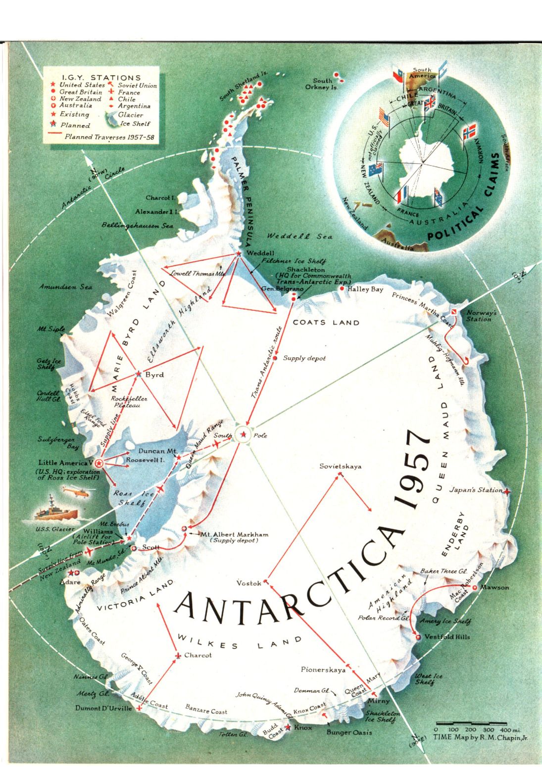
Español: Mapa de 1956 que muestra los planes en la Antártida para el Año Geofísico Internacional y los reclamos territoriales
English: Map of 1956 that shows the plans in the Antarctica for the International Geophysical Year (IGY) and the territorial claims |
| Date | |
| Source | https://content.time.com/time/subscriber/vault/1956/12/19561231/16/1550.jpg |
| Author | Chapin, Robert M. |
Licensing
This work is in the public domain because it was published in the United States between 1931 and 1963, and although there may or may not have been a copyright notice, the copyright was not renewed. For further explanation, see Commons:Hirtle chart and the copyright renewal logs.
|
 |
File history
Click on a date/time to view the file as it appeared at that time.
| Date/Time | Thumbnail | Dimensions | User | Comment | |
|---|---|---|---|---|---|
| current | 19:09, 28 May 2023 | | 1,077 × 1,454 (554 KB) | Babelia | Uploaded a work by Chapin, Robert M. from Time Magazine with UploadWizard |
File usage
The following 3 pages use this file:
Global file usage
The following other wikis use this file:
- Usage on sl.wikipedia.org