


File:Pontefract - The Counting House.jpg
No higher resolution available.
Pontefract_-_The_Counting_House.jpg (640 × 423 pixels, file size: 104 KB, MIME type: image/jpeg)
Summary
| Description |
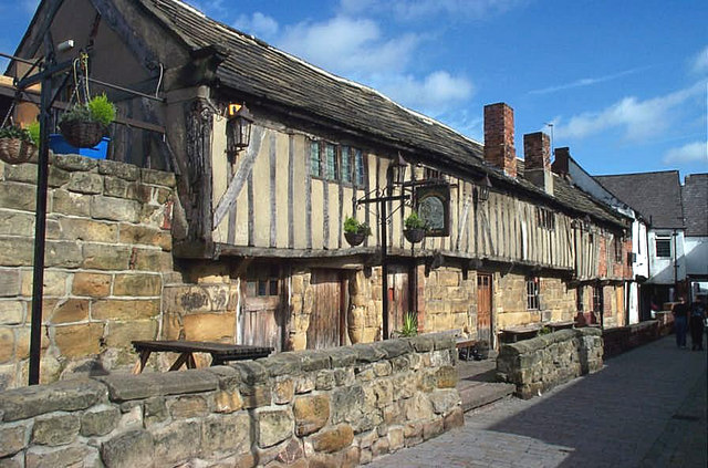
English: The Counting House Pub, Pontefract. This pub is reputed to be the oldest building in Pontefract. It has only been a pub since the 1980s, when the building which was then partially derelict, was restored and converted to its present use. |
| Date | |
| Source | From geograph.org.uk |
| Author | Bill Henderson |
| Attribution (required by the license) | Bill Henderson / The Counting House Pub, Pontefract. / |
| Camera location | | View this and other nearby images on: OpenStreetMap |
|---|
Licensing

|
This image was taken from the Geograph project collection. See this photograph's page on the Geograph website for the photographer's contact details. The copyright on this image is owned by Bill Henderson and is licensed for reuse under the Creative Commons Attribution-ShareAlike 2.0 license.
|
This file is licensed under the Creative Commons Attribution-Share Alike 2.0 Generic license.
Attribution:
Bill Henderson
- You are free:
- to share – to copy, distribute and transmit the work
- to remix – to adapt the work
- Under the following conditions:
- attribution – You must give appropriate credit, provide a link to the license, and indicate if changes were made. You may do so in any reasonable manner, but not in any way that suggests the licensor endorses you or your use.
- share alike – If you remix, transform, or build upon the material, you must distribute your contributions under the same or compatible license as the original.
File history
Click on a date/time to view the file as it appeared at that time.
| Date/Time | Thumbnail | Dimensions | User | Comment | |
|---|---|---|---|---|---|
| current | 16:10, 10 September 2009 | | 640 × 423 (104 KB) | Skinsmoke | {{Information |Description={{en|1=The Counting House Pub, Pontefract. This pub is reputed to be the oldest building in Pontefract. It has only been a pub since the 1980s, when the building which was then partially derelict, was restored and converted to i |
File usage
The following 3 pages use this file: