


File:Pillbox alongside the canal - geograph.org.uk - 1340793.jpg
No higher resolution available.
Pillbox_alongside_the_canal_-_geograph.org.uk_-_1340793.jpg (640 × 426 pixels, file size: 212 KB, MIME type: image/jpeg)
Summary
| Description |
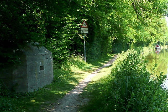
English: Pillbox alongside the canal The Kennet and Avon Canal was designated as a line of defence during WWII. There are pillboxes to be found at every bridge, and at other places. Presumably this one was sited to fill a gap between two bridges that are nearly a mile apart. It is on a bend so has a long view in each direction. |
| Date | |
| Source | From geograph.org.uk |
| Author | Graham Horn |
| Attribution (required by the license) | Graham Horn / Pillbox alongside the canal / |
| Camera location | | View this and other nearby images on: OpenStreetMap |
|---|
_heading:90.00&language=en)
| Object location | | View this and other nearby images on: OpenStreetMap |
|---|
_heading:90.00&language=en)
Licensing

|
This image was taken from the Geograph project collection. See this photograph's page on the Geograph website for the photographer's contact details. The copyright on this image is owned by Graham Horn and is licensed for reuse under the Creative Commons Attribution-ShareAlike 2.0 license.
|
This file is licensed under the Creative Commons Attribution-Share Alike 2.0 Generic license.
Attribution:
Graham Horn
- You are free:
- to share – to copy, distribute and transmit the work
- to remix – to adapt the work
- Under the following conditions:
- attribution – You must give appropriate credit, provide a link to the license, and indicate if changes were made. You may do so in any reasonable manner, but not in any way that suggests the licensor endorses you or your use.
- share alike – If you remix, transform, or build upon the material, you must distribute your contributions under the same or compatible license as the original.
File history
Click on a date/time to view the file as it appeared at that time.
| Date/Time | Thumbnail | Dimensions | User | Comment | |
|---|---|---|---|---|---|
| current | 05:17, 28 February 2011 | | 640 × 426 (212 KB) | GeographBot | == {{int:filedesc}} == {{Information |description={{en|1=Pillbox alongside the canal The Kennet and Avon Canal was designated as a line of defence during WWII. There are pillboxes to be found at every bridge, and at other places. Presumably this one was |
File usage
The following page uses this file:
Global file usage
The following other wikis use this file:
- Usage on es.wikipedia.org
- Usage on fr.wikipedia.org
- Usage on ru.wikipedia.org