


File:Myanmar Dry Zone Townships.svg

Size of this PNG preview of this SVG file: 539 × 599 pixels. Other resolutions: 216 × 240 pixels | 432 × 480 pixels | 691 × 768 pixels | 921 × 1,024 pixels | 1,843 × 2,048 pixels | 1,052 × 1,169 pixels.
Original file (SVG file, nominally 1,052 × 1,169 pixels, file size: 3.37 MB)
Summary
| Description |
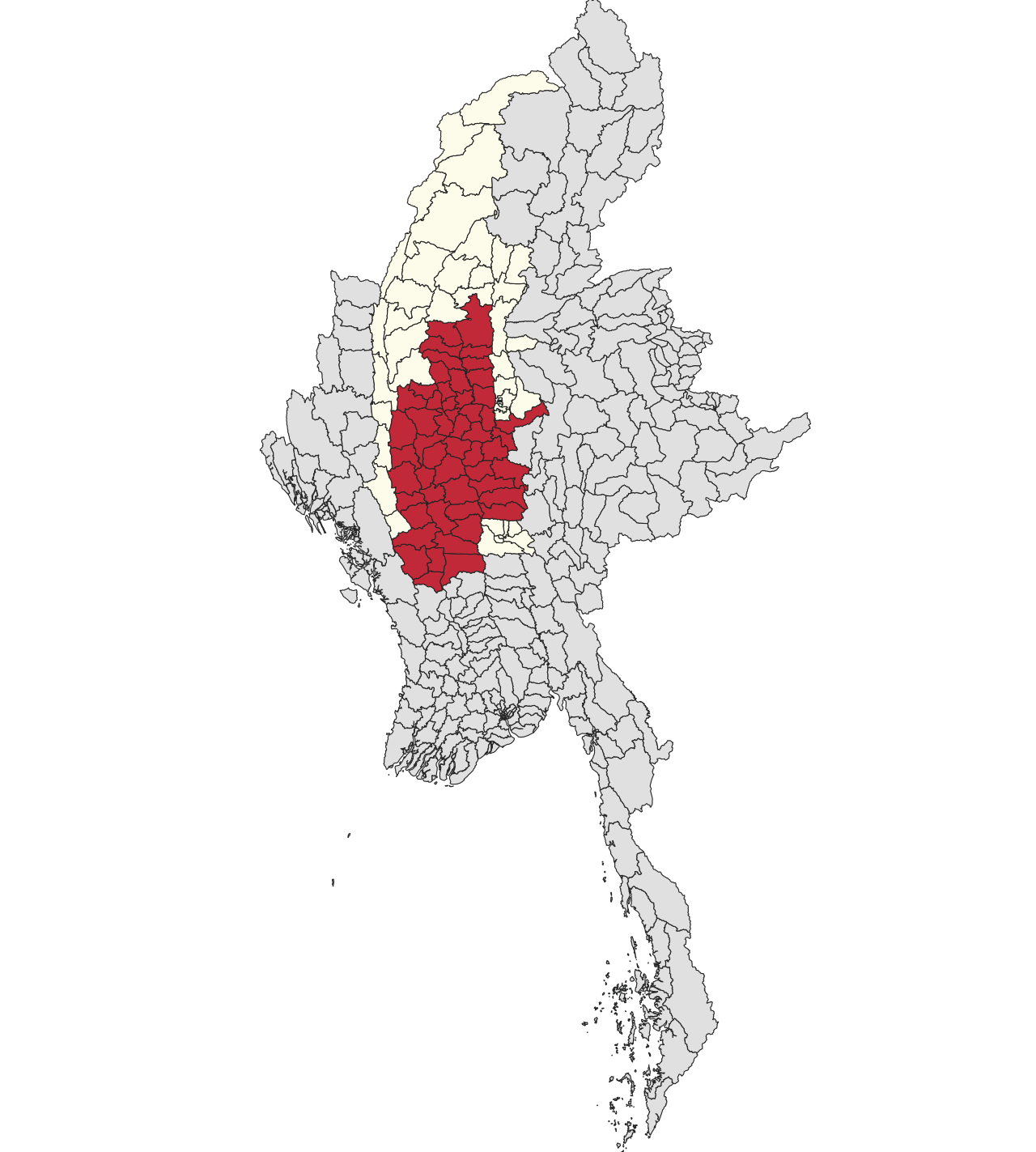
English: Townships within the Dry Zone
Regions with territory included within the Dry Zone
Townships and regions located wholly outside the Dry Zone |
| Date | |
| Source | Own work |
| Author | Mupper-san |
Licensing
I, the copyright holder of this work, hereby publish it under the following license:
This file is licensed under the Creative Commons Attribution 4.0 International license.
- You are free:
- to share – to copy, distribute and transmit the work
- to remix – to adapt the work
- Under the following conditions:
- attribution – You must give appropriate credit, provide a link to the license, and indicate if changes were made. You may do so in any reasonable manner, but not in any way that suggests the licensor endorses you or your use.
File history
Click on a date/time to view the file as it appeared at that time.
| Date/Time | Thumbnail | Dimensions | User | Comment | |
|---|---|---|---|---|---|
| current | 07:34, 8 January 2024 | | 1,052 × 1,169 (3.37 MB) | Mupper-san | Uploaded own work with UploadWizard |
File usage
The following 19 pages use this file:
- Dry Zone (Myanmar)
- Dry Zone theater
- Kanbalu District
- Kyaukse District
- Magway District
- Meiktila District
- Minbu District
- Monywa District
- Myingyan District
- Nyaung-U District
- Ottara District
- Pakokku District
- Sagaing District
- Shwebo District
- Tada-U District
- Thayet District
- Yamethin District
- Yinmabin District
- Template:Dry Zone
Global file usage
The following other wikis use this file:
- Usage on fr.wikipedia.org
- Usage on id.wikipedia.org
- Usage on it.wikipedia.org
- Usage on ja.wikipedia.org
- Usage on my.wikipedia.org
- Usage on zh.wikipedia.org