


File:East Dundry, Bristol 1842 tithe map.jpg
Size of this preview: 508 × 600 pixels. Other resolutions: 203 × 240 pixels | 407 × 480 pixels | 650 × 768 pixels | 867 × 1,024 pixels | 2,127 × 2,511 pixels.
Original file (2,127 × 2,511 pixels, file size: 1.1 MB, MIME type: image/jpeg)
Summary
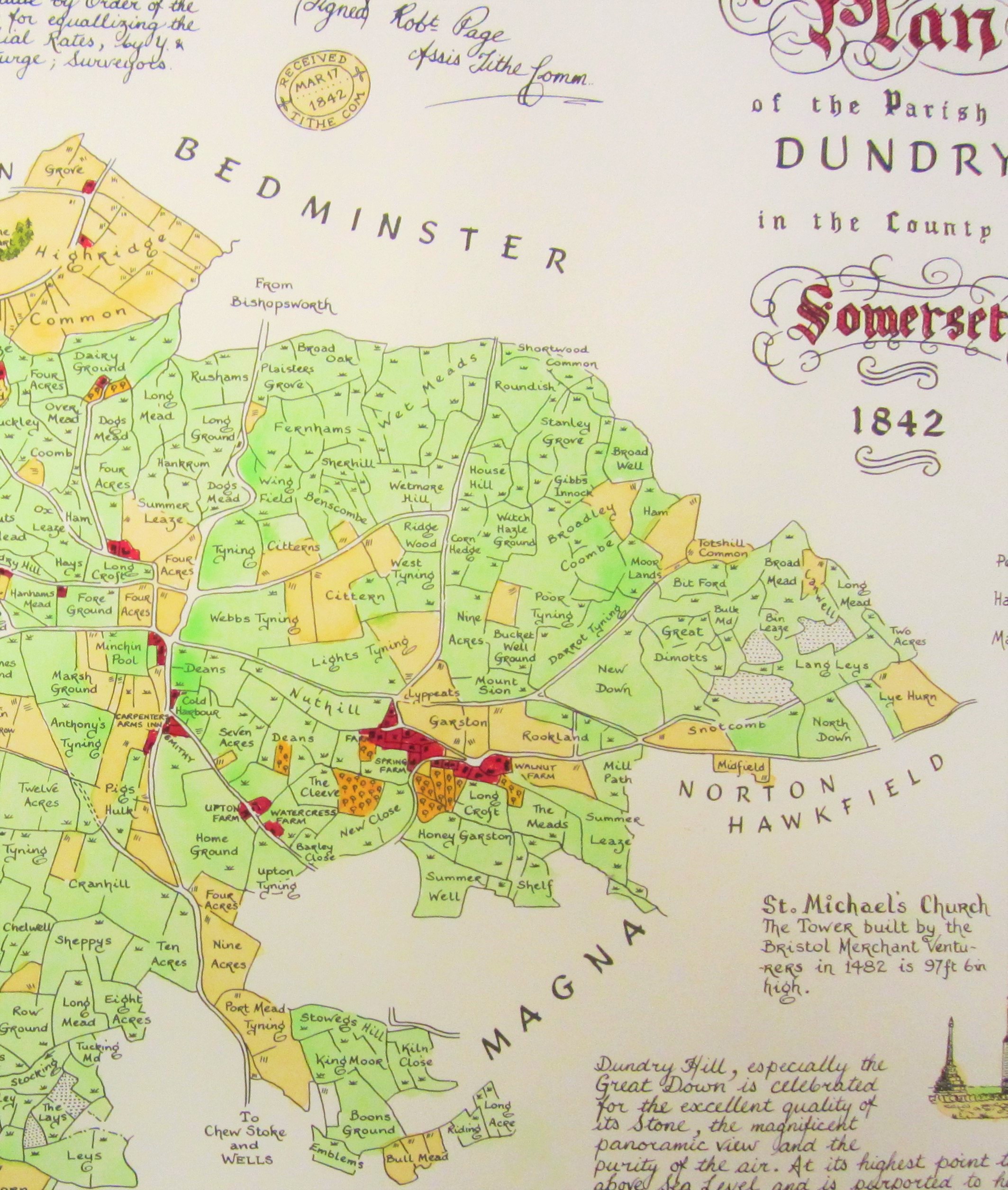
Photo by me of British authorities' 1842 "tithe map" for East Dundry near Bristol, England.
Licensing
I, the copyright holder of this work, hereby publish it under the following license:
File history
Click on a date/time to view the file as it appeared at that time.
| Date/Time | Thumbnail | Dimensions | User | Comment | |
|---|---|---|---|---|---|
| current | 20:53, 4 December 2020 | | 2,127 × 2,511 (1.1 MB) | Duncanogi (talk | contribs) | Photo by me of British authorities' 1842 "tithe map" for East Dundry near Bristol, England. |
You cannot overwrite this file.
File usage
The following 2 pages use this file: