


File:AegisAshore DeckHouseComplex in Hawaii.jpg

Size of this preview: 800 × 600 pixels. Other resolutions: 320 × 240 pixels | 640 × 480 pixels | 1,024 × 768 pixels | 1,280 × 960 pixels | 2,560 × 1,920 pixels | 3,264 × 2,448 pixels.
Original file (3,264 × 2,448 pixels, file size: 1.74 MB, MIME type: image/jpeg)
Summary
| Description |
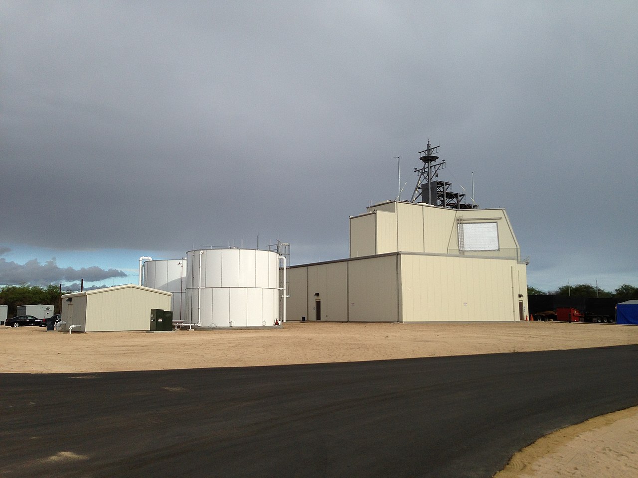
日本語: イージスアショア施設(ハワイ州カウアイ島 太平洋ミサイル試射場)
English: The deckhouse for the Aegis Ashore system at the Pacific Missile Range Facility. This is the test asset for the Aegis Ashore system that will be emplaced in Romania and Poland. |
| Date | |
| Source | https://www.mda.mil/global/images/system/aegis/AegisAshore_photo1.jpg Missile Defense Agency Photo |
| Author | Missile Defense Agency - United States Department of Defense |
| Camera location | | View this and other nearby images on: OpenStreetMap |
|---|
Licensing
This work is in the public domain in the United States because it is a work prepared by an officer or employee of the United States Federal Government as part of that person’s official duties under the terms of Title 17, Chapter 1, Section 105 of the US Code.
Note: This only applies to original works of the Federal Government and not to the work of any individual U.S. state, territory, commonwealth, county, municipality, or any other subdivision. This template also does not apply to postage stamp designs published by the United States Postal Service since 1978. (See § 313.6(C)(1) of Compendium of U.S. Copyright Office Practices). It also does not apply to certain US coins; see The US Mint Terms of Use.
|
 | |
| This file has been identified as being free of known restrictions under copyright law, including all related and neighboring rights. | ||
File history
Click on a date/time to view the file as it appeared at that time.
| Date/Time | Thumbnail | Dimensions | User | Comment | |
|---|---|---|---|---|---|
| current | 22:29, 17 March 2020 | | 3,264 × 2,448 (1.74 MB) | Motokoka | Uploaded a work by Missile Defense Agency - United States Department of Defense from https://www.mda.mil/global/images/system/aegis/AegisAshore_photo1.jpg Missile Defense Agency Photo with UploadWizard |
File usage
No pages on the English Wikipedia use this file (pages on other projects are not listed).