


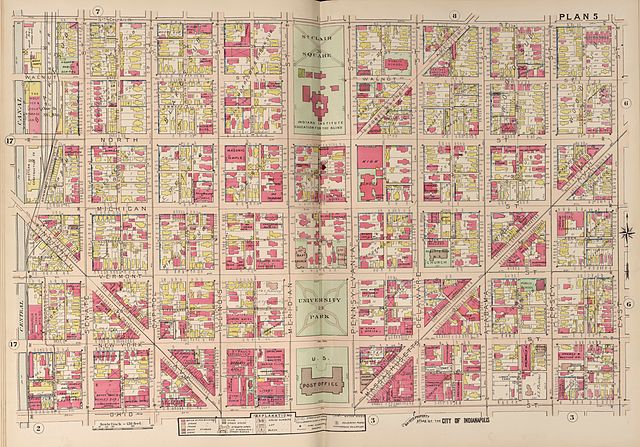
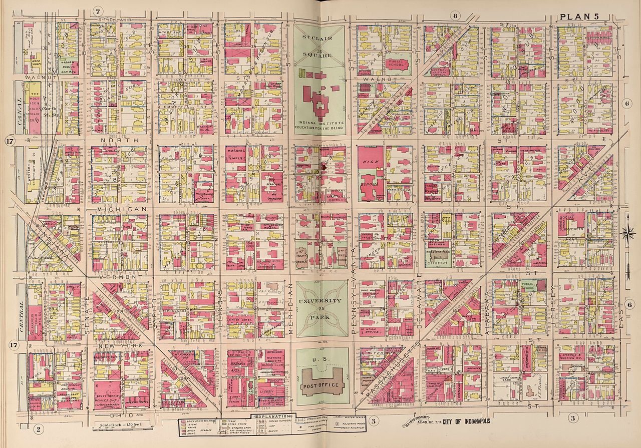
Size of this preview: 800 × 559 pixels. Other resolutions: 320 × 224 pixels | 640 × 447 pixels | 1,024 × 716 pixels | 1,280 × 895 pixels | 2,560 × 1,789 pixels | 12,336 × 8,622 pixels.
Original file (12,336 × 8,622 pixels, file size: 7.02 MB, MIME type: image/jpeg)
| Warning | The original file is very high-resolution. It might not load properly or could cause your browser to freeze when opened at full size. |
|---|
| Description |
English: Plan 5, of: Baist's real estate atlas of surveys of Indianapolis and vicinity, Indiana : complete in one volume : compiled and published from official records, private plans and actual surveys / by G. Wm. Baist, Wm. E. & H.V. Baist, surveyors. |
| Date | |
| Source | http://hdl.loc.gov/loc.gmd/g4094im.gct00193 |
| Author | Baist |
This media file is in the public domain in the United States. This applies to U.S. works where the copyright has expired, often because its first publication occurred prior to January 1, 1930, and if not then due to lack of notice or renewal. See this page for further explanation.
|
 | |
 |
File history
Click on a date/time to view the file as it appeared at that time.
| Date/Time | Thumbnail | Dimensions | User | Comment | |
|---|---|---|---|---|---|
| current | 13:16, 8 October 2012 | | 12,336 × 8,622 (7.02 MB) | M2545 | {{Information |Description=Plan 5, of: Baist's real estate atlas of surveys of Indianapolis and vicinity, Indiana : complete in one volume : compiled and published from official records, private plans and actual surveys / by G. Wm. Baist, Wm. E. & H.V... |
File usage
The following page uses this file: