


No higher resolution available.
Bahrain_map.png (334 × 355 pixels, file size: 9 KB, MIME type: image/png)
| Description |
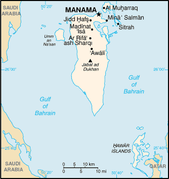
English: A map of the Bahrain, showing major cities. |
|||
| Date | published 2004 | |||
| Source | CIA, The World Factbook, 2004. | |||
| Author | CIA | |||
| Permission (Reusing this file) |
|

File history
Click on a date/time to view the file as it appeared at that time.
| Date/Time | Thumbnail | Dimensions | User | Comment | |
|---|---|---|---|---|---|
| current | 14:48, 21 May 2005 | | 334 × 355 (9 KB) | Nord68 | {{PD-USGov-CIA-WF}} |
File usage
The following 12 pages use this file:
- 2011 Bahraini uprising
- Energy in Bahrain
- Gulf of Bahrain
- History of the Jews in Bahrain
- Karim Fakhrawi
- List of cities in Bahrain
- Sitra
- Territorial disputes in the Persian Gulf
- User:Chickstarr404/Gather lists/13386 – "A Travelers Alphabet" by Stephen Runciman
- User:Morriswa/My OCONUS travel
- Module:Location map/data/Bahrain
- Module:Location map/data/Bahrain/doc
Global file usage
The following other wikis use this file:
- Usage on af.wikipedia.org
- Usage on als.wikipedia.org
- Usage on ar.wikipedia.org
- Usage on ast.wikipedia.org
- Usage on ast.wiktionary.org
- Usage on az.wikipedia.org
- Usage on ban.wikipedia.org
- Usage on be-tarask.wikipedia.org
- Usage on bg.wiktionary.org
- Usage on bn.wikipedia.org
- Usage on ca.wikipedia.org
- Usage on ckb.wikipedia.org
- Usage on cs.wikipedia.org
- Usage on cy.wikipedia.org
- Usage on de.wikipedia.org
- Usage on de.wiktionary.org
- Usage on el.wikipedia.org
- Usage on en.wikibooks.org
- Usage on en.wikisource.org
- Usage on en.wiktionary.org
- Usage on es.wikipedia.org
- Usage on es.wikibooks.org
- Usage on fa.wikipedia.org
- Usage on fi.wikipedia.org
- Usage on fr.wikipedia.org
- Usage on fy.wikipedia.org
- Usage on gd.wikipedia.org
- Usage on gl.wikipedia.org
- Usage on hak.wikipedia.org
- Usage on hi.wikipedia.org
- Usage on hr.wikipedia.org
- Usage on hu.wikipedia.org
View more global usage of this file.
You must be logged in to post a comment.